Cycling the Golden Gate Bridge to Sausalito and Tiburon

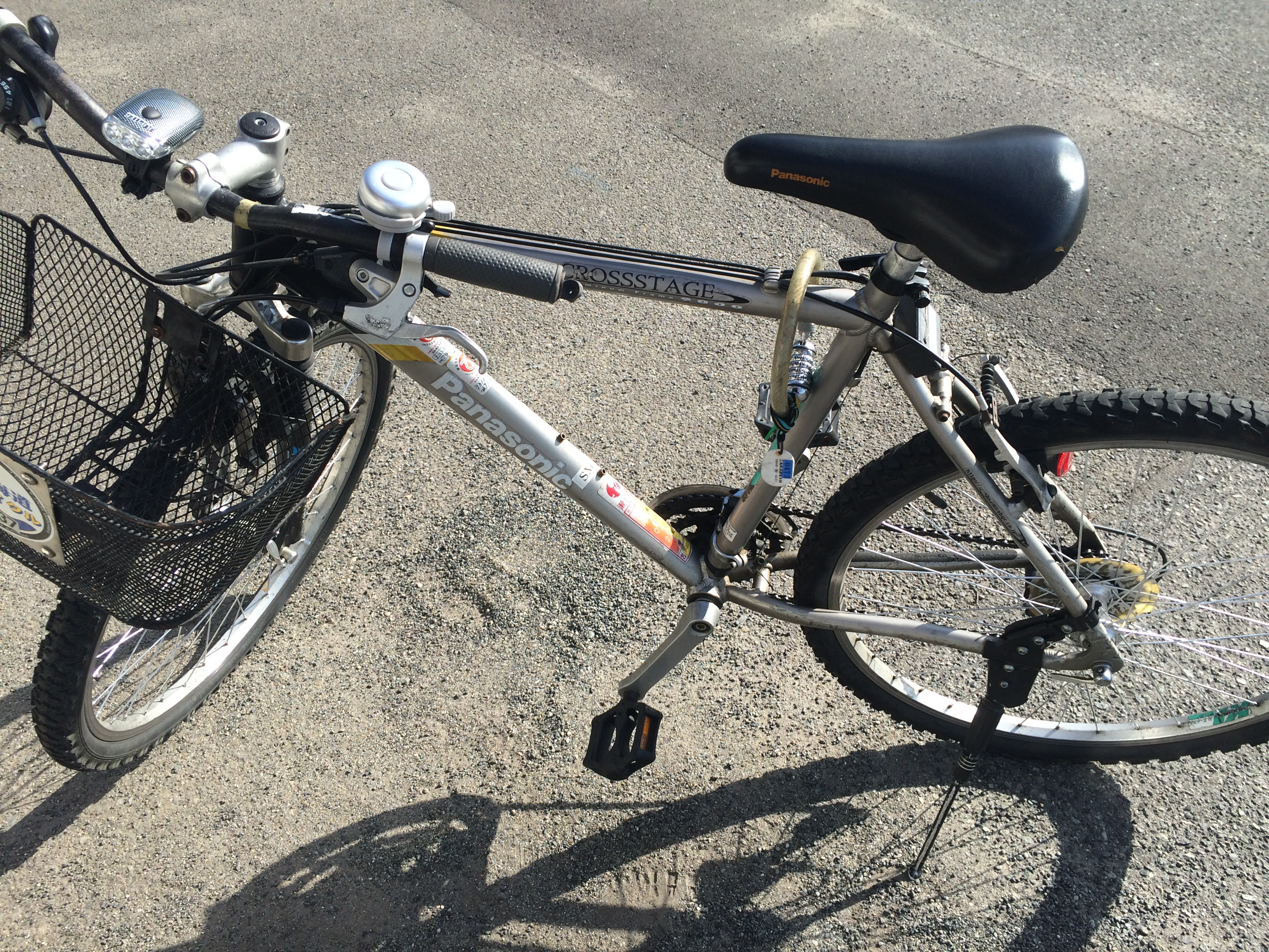
I picked up the bike at the rental store on Pier 39, upwind of the sealions, and pedalled along the Embarcadero past the crab and clam chowder stands of Fisherman’s Wharf and dropped down to Beach and joined the trail which cut through Fort Mason where I was staying in a hostel in an old wooden building which used to be part of an army base dating back to the Civil War.

“The coldest winter I ever spent,” said Mark Twain, “was a summer in San Francisco”. The city is often shrouded in what Kerouac called “an advancing wall of potato-patch fog”. But it was clear and bright the whole time I was there and warm until late afternoon when you all at once needed a coat. 

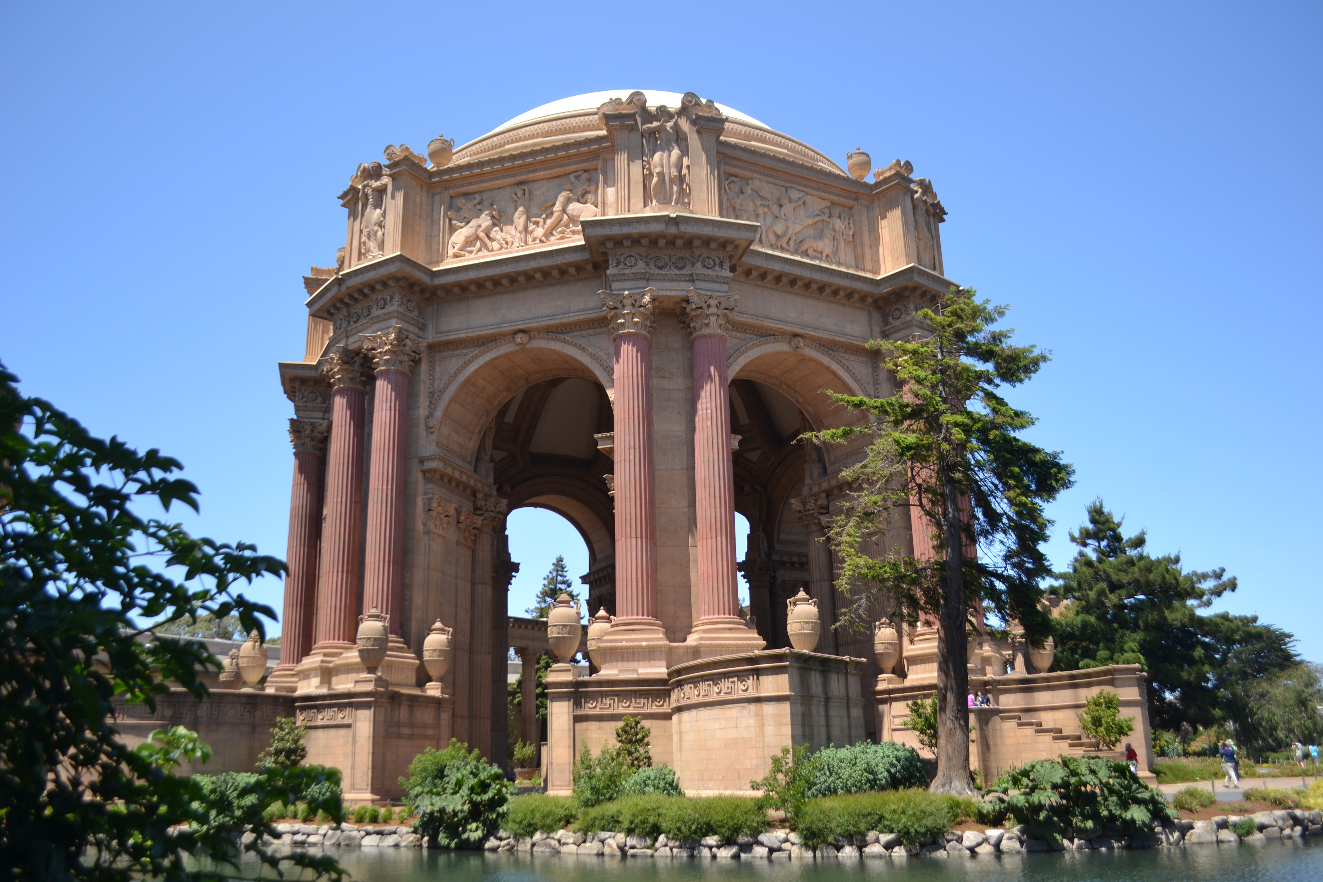
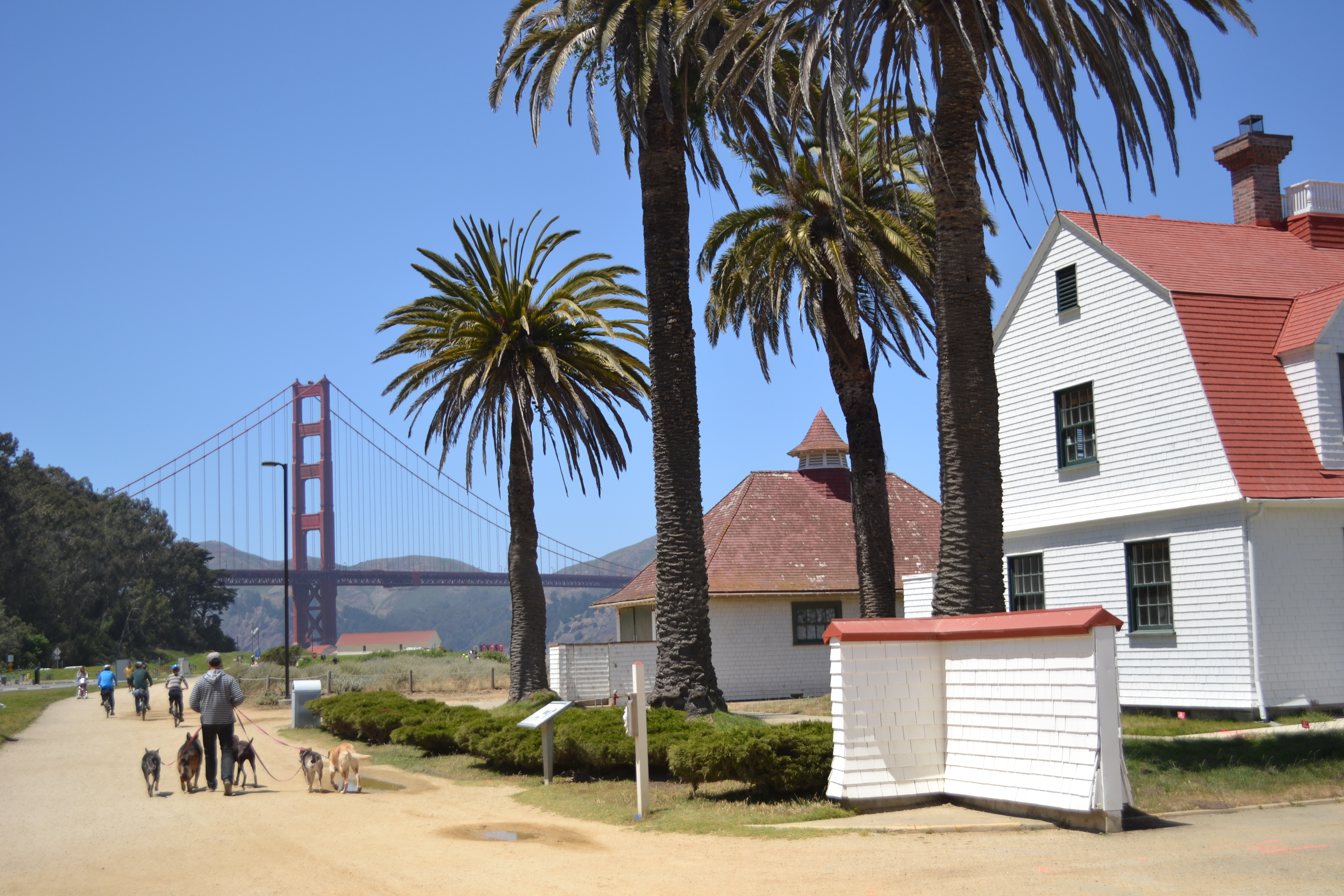
I rode alongside the marina and took a slight detour to poke around the Palace of Fine Arts, built in 1915 for the Panama-Pacific Exposition. Then I rejoined the trail and cycled under palms along the shore at Crissy Fields, past pretty wooden buildings which were once a coast guard station and further along, at the opposite side, century-old seaplane hangers.  

The Golden Gate Bridge was centre stage in the distance and I headed towards it, navigating around a professional dog-walker with a fleet of dogs of various breeds and sizes and a family riding bikes three abreast.

The trail ran alongside the Bay and water lapped against the rocks. The stanchions and chains of the fence beside it were rusted where waves had lashed them. Fort Point came into view. It was built about a century before the bridge which now towers over it, just before the Civil War. It was there in Vertigo that Kim Novak’s character faked an attempt at suicide.

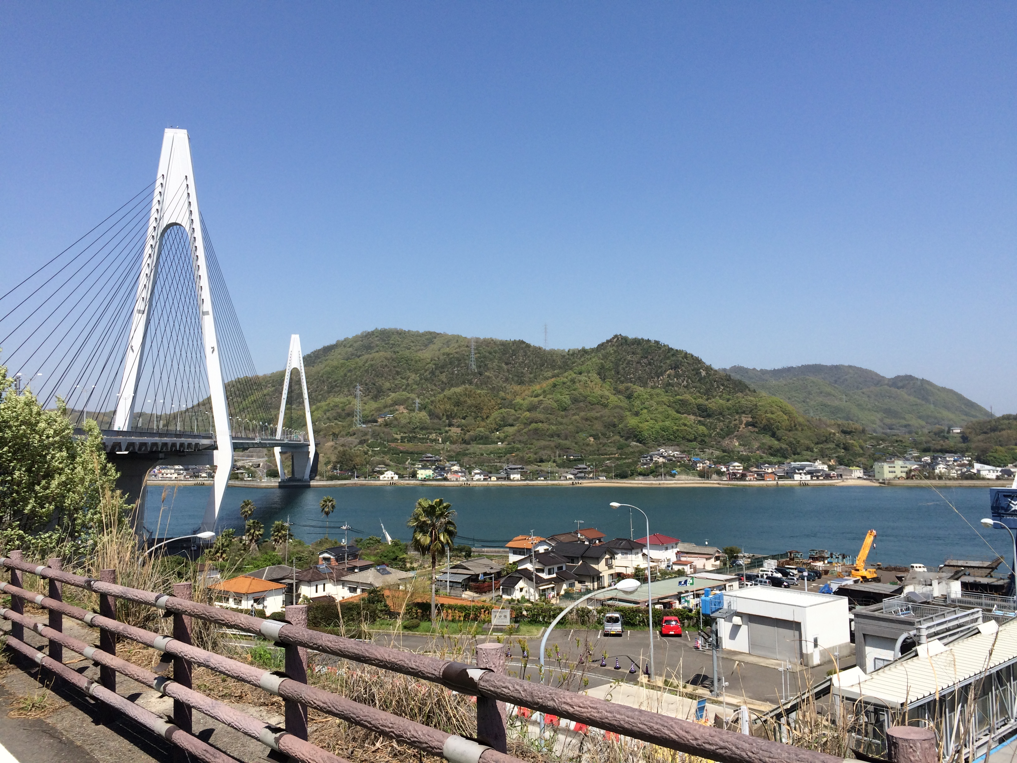
I pressed on towards it then found my way up to the carriageway onto the bridge and, though I had crossed it before on foot, still felt a slight thrill passing under the iconic towers. I crossed the Bay into Marin County and wound down the hill to Sausalito. 

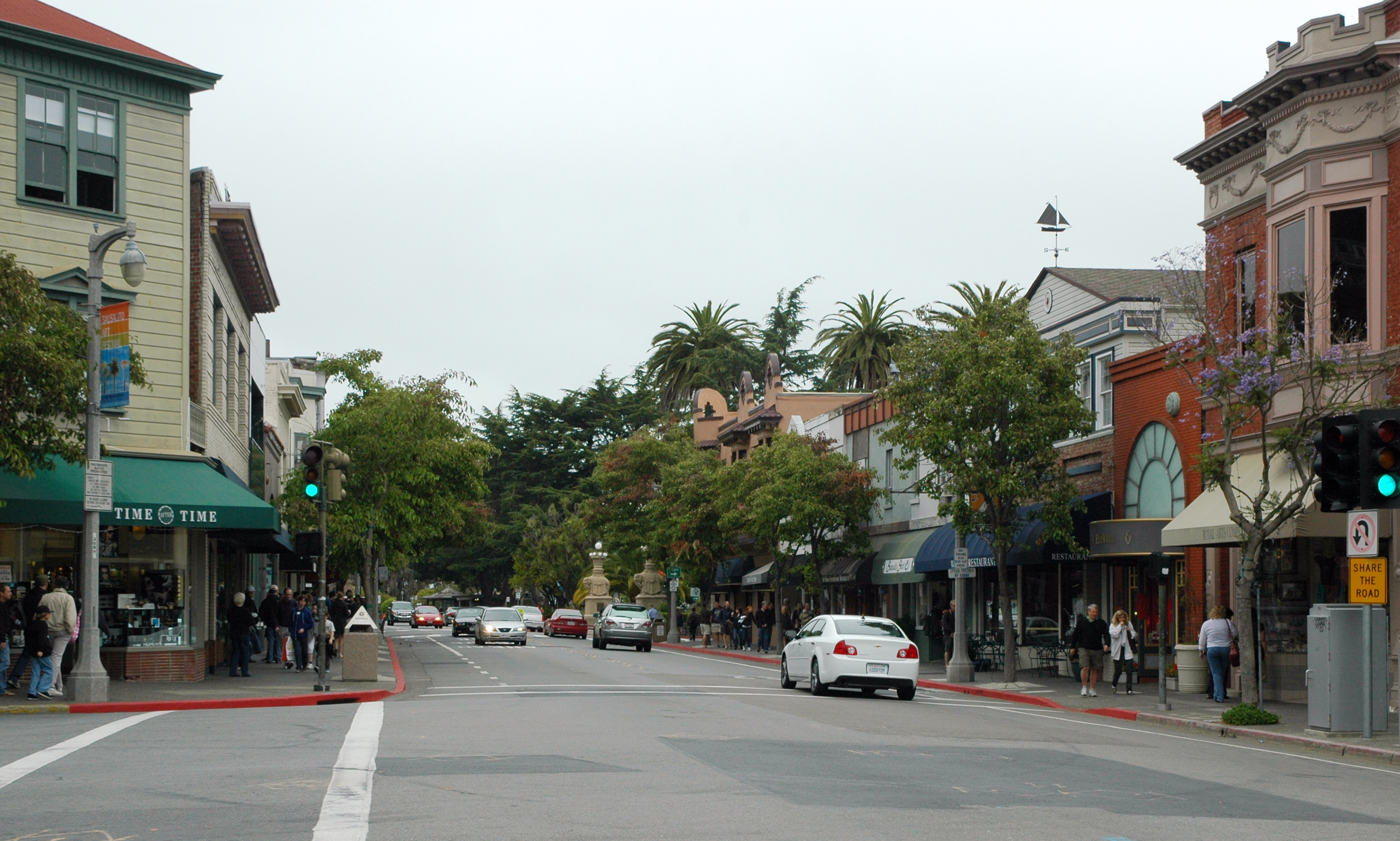
It is technically a city in its own right but it is hard to see it that way when it only takes up two square miles and has a population of just 7,000. Kerouac wrote of it in On the Road as a “little fishing village”.

It was a bohemian enclave in his day and still was in the Sixties when Cosmopolitan wrote of:

“Sausalito, just across the Golden Gate Bridge from San Francisco, a lovely stretch of land resembling the French Riviera, is an artists’ colony that can best be described as Barge Bohemia. It’s a pleasant place that looks a little like Monte Carlo, with gaily painted houses hanging on the hillside and a harbor crammed with the strangest flotilla I’ve ever seen: ferry boats, broken-down barges, houseboats and, here and there, a sleek yacht or two.”

It has gone steadily upmarket since then and is home now to Isabel Allende and Dave Eggars. There are big houses among the trees in the hills and Porsches and Ferraris parked in the street and delis and designer shops along the main drag. But the modern-day affluence has not bought out the atmosphere.

DimiTalen / Wikimedia Commons*

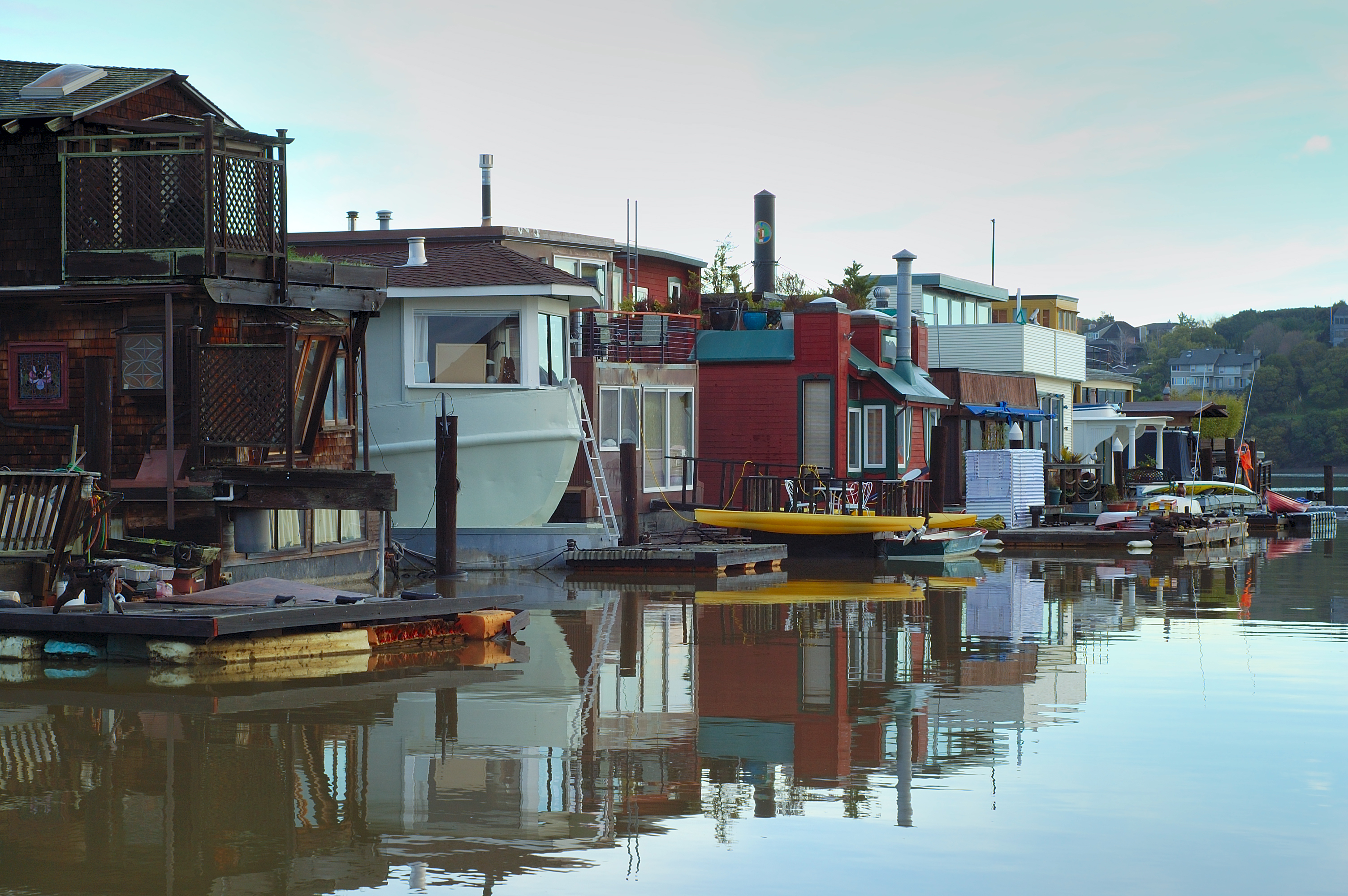
I cycled through the middle of town and alongside the harbour. There have been houseboats in Sausalito since at least 1906 when the earthquake left San Francisco in ruins. A shipyard was built at the edge of town in World War II and. after it closed, old ferries and landing crafts and barges were moored there and ramshackle living quarters built on them from scavenged materials.

One boat had sash windows reclaimed from a house, another repurposed a railway carriage. As they rotted they were set onto concrete platforms. There are about 400 of them now and, at least from a distance, they still have a freewheeling, hippy aesthetic, but can sell for $2m.

Leaving Sausalito, the trail continued along the Bay and over Coyote Creek and into the Bothin Marsh Preserve. Wading birds tottered through the wetlands and the sun glistened on the surface of the bay and ahead, in the distance, loomed Mount Tamalpais.

Stas Volik / Shutterstock.com

I had been on a bike just three times in the best part of six months since I left home and this was the first ride of any length, but it was a perfect day for cycling and I felt as if I could go on until nightfall.

I rattled over the bridge and through Bayfront Park and over another bridge onto the opposite side of the Bay and traced the headland round. I rode through quiet and comfortable residential neighbourhoods until again confronted with the expanse of the Bay. The houseboats of Sausalito were on the opposite shore now, in the distance ahead the Golden Gate Bridge and beyond it Alcatraz Island and to its right the skyline of San Francisco.

I climbed up Strawberry Drive and descended into Harbour Cove, round the marina and onto the road towards Tiburon. Somewhere along the way I had picked up a slow puncture and the tyre was properly flat by the time I got into town and bumped and wobbled towards the pier for the ferry back to San Francisco.

© Richard Senior 2021

*By DimiTalen – Own work, CC0, https://commons.wikimedia.org/w/index.php?curid=31166480

Cycling the Shimanami Kaidō

image1 (9)

I set off too late from Hiroshima, then got the wrong train, and it was going on for lunchtime when I reached Onomichi. But I decided to skip lunch because I wanted to cycle at least some of the Shimanami Kaidō between the eight islands, from Honshu to Shikoku, across the suspension bridges over the Inland Sea.

I have since read about travellers planning and training for the ride for weeks and basing their trips to Japan around it, but I am too spontaneous, too chaotic for anything like that. I had found out about the Shimanami Kaidō by chance a day or two before when looking for something else in the guidebook.

It is a 70km (43 mile) route, end to end, and my guidebook reckoned it would take somewhere around eight hours to ride, which to me seemed too pessimistic. I reckoned four or five.

IMG_2979

The rent-a-bike point was hidden in a car park but I found it eventually and chose a cheap ‘mountain bike’ over a selection of old ladies’ shopping bikes. I revised my estimate to five or six hours when I saw it, dropped my daybag into the basket and rattled along the waterfront to the ferry across the Onomichi-suido Channel. I had picked up a map of the route but it was, in any case, marked with blue and white lines on the road. It would be hard to get lost.

If I wanted my deposit back, I would have to return the bike to Onomichi before 6pm, but the deposit was only ¥1000, or £5.89. (The hire cost was half that, which made it a cheap afternoon’s entertainment.) I saw when I skim-read the back of the map that I could drop off the bike at the end, or at points along the way, and take a bus back; and that was all I needed to know, for the moment.

The bike was too low-geared to go anywhere fast, but the route was flat – or at least so it seemed after the merciless hills of northern England – and the sun was hot and it was a perfect day for cycling. The route took me through a slice of Japan which you rarely see as a tourist, neither the sleepy towns of old wooden houses, nor the bustling cities of neon-lit skyscrapers, just workaday hamlets with a few houses and shops, a filling station, then nothing until a big-hammer factory, and nothing again for the next ten minutes.

IMG_2969 edit

I tracked diagonally across Mukaishima Island and came out at the waterfront and followed its contours round towards the Innoshima suspension bridge. The blue and white lines led under the bridge and round a corner and then twisted back on themselves up a steep hill which spiralled to the cycle lane of the bridge suspended beneath the roadway.

Two hours in, I had worked across Innoshima Island and traversed the Ikushi Bridge, with orchids lining the approach road and big barges trundling underneath and the sun glinting off the water. I was on the fourth island of eight and seemed to be making good time.

There is apparently a temple worth seeing on Ikuchijima Island but I was too focussed to detour to it, and in any case I had been to Nikkō, Nara and Kyoto already on that trip and would not feel cheated if I never saw another temple. There were, as well, a few curiosities at the side of the road: an old bus in faded psychedelic paint in the style of Ken Kesey’s Furthur and a group of life-size dummies seated in a row as if they were waiting for a bus.

DSC_0837

It took me somewhere around an hour to get to the next bridge, 36 kilometres from Onomichi, a little over half way to Imabari. I had, it seemed, been wildly optimistic to think that I could finish the route in four hours but about right with the more conservative six. I was not sure why the guidebook thought you needed eight, but then the map said eight to ten and I have since read that some travellers spread the ride over a couple of days.

I could still, just about, have turned the bike round and headed back to Honshu before the rent-a-bike terminal closed, but I was enjoying myself too much for that. The other terminals, I saw when I read the back of the map properly, closed at 5pm. There was an outside chance that I could get all the way to Imabari on the edge of Shikoku and find the terminal in time, but it was no more than an outside chance.

There were three other terminals along the way, so there was no need to give up just yet. It was a lovely ride along the waterfront on Omishima Island and across the arched bridge to Hakatajima, where I caught up with a group of serious cyclists with sprayed-on lycra and bikes made from carbon fibre and fresh air and passed a couple of them; but there was too much face to be lost in being overtaken by a tourist in street clothes on a pig-iron mountain bike, so they clunked down a gear and streaked past me.

IMG_2976

I decided as I snaked through the national park to the west of Hakatajima Island to drop off the bike at the next terminal, just before the Hakata-Oshima suspension bridge, the last but one before Imabari. I only had 20km left to ride to the end of the route, and plenty of energy, but by then it was clearly too late to get there before 5pm.

I imagined the bus interchange to be a big building with helpful things like timetables and an information desk, but it was actually just a turning circle with a few wooden shelters. There was no one else around. In a few of the shelters, there were photocopied sheets with bus times on them but the destinations – naturally – were only in Japanese. The last bus going anywhere seemed to be at half-past five.

At somewhere around twenty-past, a bus pulled in but the driver denied that he was going to Onomichi.

IMG_2975

Of course I had no contingency plan and I thought I would be lucky even to find an English-speaker within reasonable walking distance, let alone a hotel or a taxi firm. If it came to it, I supposed I would just have to walk back to Honshu.

But then, at something to six, the bus turned up.

© Richard Senior 2016